
Baileyton Mitigation Bank
CONTACT


Baileyton Mitigation Bank
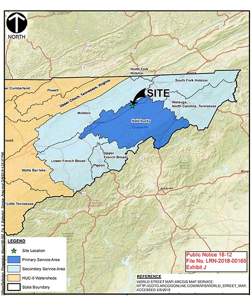
Service Area Map
PROJECT SNAPSHOT
Project Type
Mitigation BankLocation
Tennessee | Greene CountyService Area
06010102-South Fork Holston | 06010104-Holston | 06010105-Upper French Broad | 06010107-Lower French Broad | 06010108-NolichuckyProject Size
- Streams: 12,000 LF
Solution
Wetland and Stream MitigationCredit Types
- Riparian
- Stream
Ask About Credits
The Baileyton Mitigation Bank is located on 231 acres of a former golf course and agricultural pasture land. Due to previous land use practices, onsite streams have experienced severe degradation, loss of riparian buffers, and direct livestock access to stream channels. Streams chosen for restoration were characterized by bank erosion, loss of floodplain connection, and general instability caused by ongoing channel evolution.
RES is incorporating natural channel design and construction techniques to restore 2.3 miles of degraded and piped headwater intermittent and perennial streams and riparian habitat. The mitigation and restoration activities will generate 9,265 stream credits in the Nolichucky Watershed of Eastern Tennessee. The service areas will also include Holston, Lower French Broad, Nolichucky, Pigeon, South Fork Holston, Upper French Broad, and Watuaga watersheds.