- People
- Working Here
-
-
A Career with an Impact
View Available Jobs »
-
Student Internship Opportunities
Learn More »
-
-
- Safety (EHS&S)
Creating a Culture of Safety
Our team is dedicated to empowering team members with safety leadership and promoting a safe, secure and environmentally- friendly work environment in all facets of our business.
- Landowners
Find Landowner Representative in my State
Explore making part of your land, a legacy of resiliency for future generations.
- Vendors
Fast-track your path to being a potential RES supplier.
VENDOR APPLICATION
- Working Here
- Capabilities
- Our Solutions
- Our Approach
What is “Active Stewardship”?
At RES, we don’t build sites and walk away. We design them to thrive, and stick around until they do.
- Industries
- Videos
- Our Solutions
- Places
- Buy Credits
Buy Mitigation Credits
Impacts are sometimes unavoidable. For these situations, we offer ecological offsets in the form of mitigation credits.
- Find Projects
Find Projects
RES delivers resiliency, project by project. Understanding them is the best way to get to know us.
- Search States
Search by State
Keeping the ecological balance is an intensely local endeavor. See how we meet the challenge in your area.
- Nurseries
-
- Buy Credits
- About Us
- Who We Are
Restoration is part of the answer to creating a resilient world.
Learn more »
- Leadership Team
Meet our Leadership Team
- Acquisitions
We are growing the RES family.
We strengthen our team by bringing on respected teams of experts with local knowledge and experience, who share our vision of a resilient earth.
- News
RES in the News
Read the latest news about RES, our projects and our people.
- Who We Are
- Restoring at Scale
- Buy Credits
- Contact Us
Places > BLM Wildfire Study
BLM Wildfire Study
PROJECT SNAPSHOT
Project Type
Non-Bank ProjectSolution
Climate Adaptation & Flood Resilience, Natural Resource Planning/RestorationCONTACT
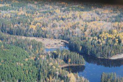
To help the U.S. Bureau of Land Management understand the vulnerability to wildfire on 15 of its remote parcels in northeast Minnesota, RES collected aerial imagery and applied remote sensing and GIS techniques to generate high-resolution data and GIS models that estimated wildfire vulnerability.
Flights to collect high-resolution multispectral imagery were strategically timed in October to maximize the diversity of spectral reflection provided by fall colors, thus improving the automated classification of vegetation cover.
Geospatial specialists processed data into four spectral bands (red, green, blue, and near-infrared) stacked as one data layer to further refine land cover classification and assist with interpreting vegetation community types, such as deciduous forest, grassland, herbaceous wetland, etc.
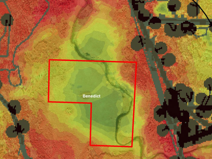
Using the aerial imagery data, RES developed a GIS-based wildfire vulnerability model comprised of three interrelated parts: 1) potential fuel source for ignition (ignition potential model); 2) potential fuel load of vegetation cover; and 3) connectivity between ignition sources and fuel loads.
The final report to BLM provided a Wildfire Vulnerability Score for each parcel and its adjacent half-mile perimeter buffer.