Dover Farm Wetland Mitigation Bank
CONTACT
Credit Sales Coordinator, Virginia

Dover Farm Wetland Mitigation Bank

Dover Farm Wetland Mitigation Bank | Old and new trees

Dover Farm Wetland Mitigation Bank | Wetlands

Dover Farm Wetland Mitigation Bank | Wetlands
PROJECT SNAPSHOT
Project Type
Mitigation BankLocation
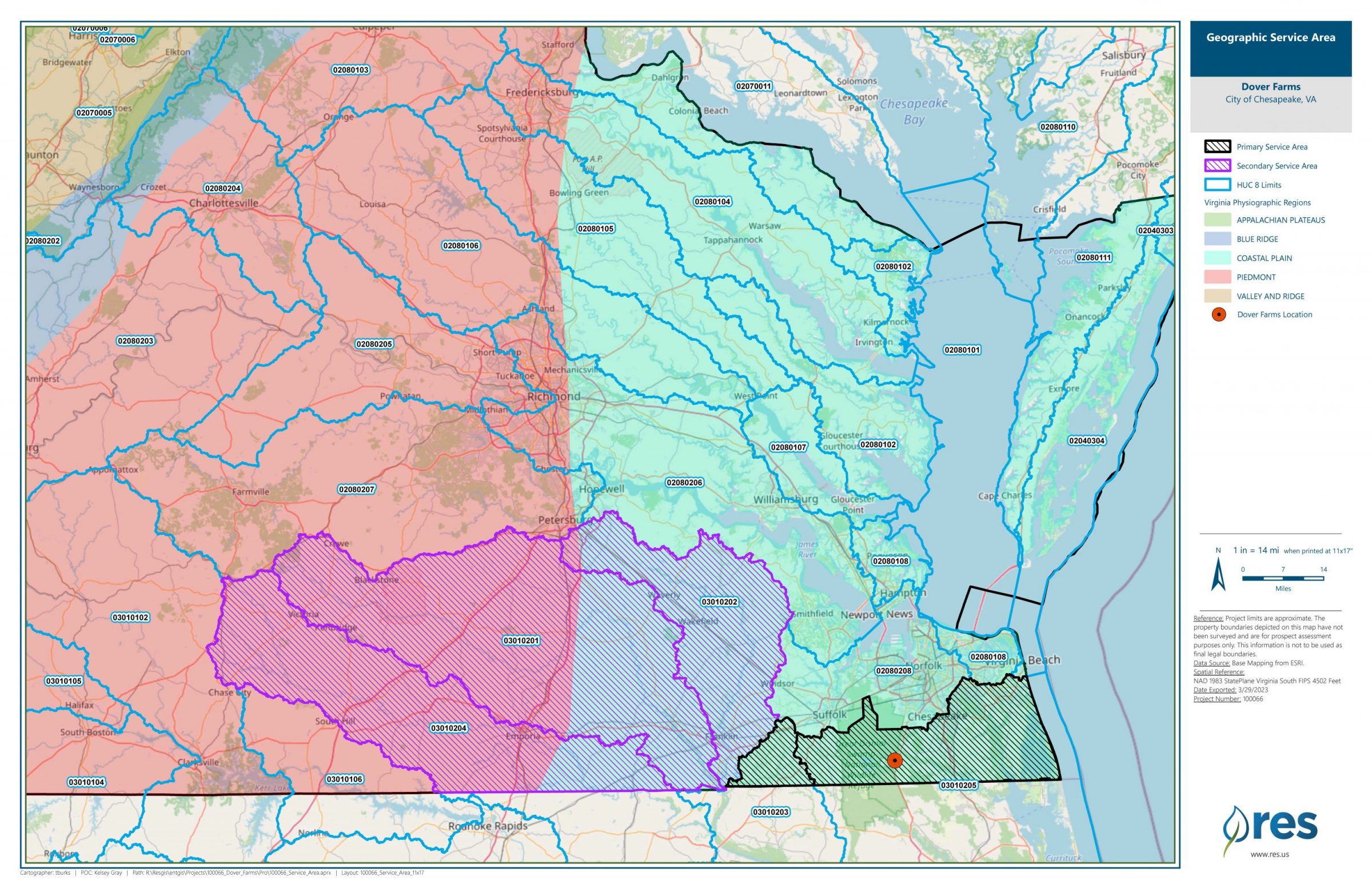
Virginia | Chesapeake CountyService Area
Chesapeake BayProject Size
- Wetland: 1030.72 AC
Solution
Wetland and Stream MitigationCredit Types
- Bottomland hardwood forest
- Marsh
- Riparian
- Wetland
Species
Canebrake rattlesnakeAsk About Credits
The Dover Farm Mitigation Bank was established in 2008 to provide compensatory mitigation for unavoidable impacts to non-tidal wetlands within the Albemarle Sound-Chowan River drainage basin (HUC 03010205). Designed to preserve and restore valuable wetland ecosystems, the bank plays a vital role in protecting this important watershed.
Located on the west side of the Dismal Swamp Canal in Chesapeake, Virginia, the site lies within the historic bounds of the Great Dismal Swamp. To the north and west, it shares borders with the Great Dismal Swamp National Wildlife Refuge, enhancing landscape connectivity and conservation value.
The 966-acre bank includes:
-
686.1 acres of restored wetlands
-
243.3 acres of preserved wetlands
-
33.5 acres of upland buffer
Prior to restoration, the Dover Farm site was used for agriculture until 2009. Restoration efforts focused on reestablishing natural hydrology and native vegetation. Key actions included filling historic agricultural ditches with on-site material, constructing a water control structure, and planting approximately 200,000 native trees to accelerate forested wetland recovery.
Dover Farm Mitigation Bank exemplifies large-scale ecological restoration and long-term protection of sensitive wetland resources in southeastern Virginia.
Learn more about this project by visiting the Dover Farm Mitigation Bank StoryMap.