Mapping Woody Invasive Species in Shawnee National Forest with Aerial Imagery


PROJECT SNAPSHOT
Project Type
Non-Bank ProjectLocation
Illinois | 11 Counties in Southern IllinoisSolution
Natural Resource RestorationEcological Setting
Grasslands, Prairies, & Upland ForestsShawnee RC&D, a regional non-profit, was concerned about the impact woody invasive species (bush and Japanese honeysuckles, autumn olive, and multiflora rose) were having on the quality of natural woodlands in southern Illinois, particularly in the Shawnee National Forest.
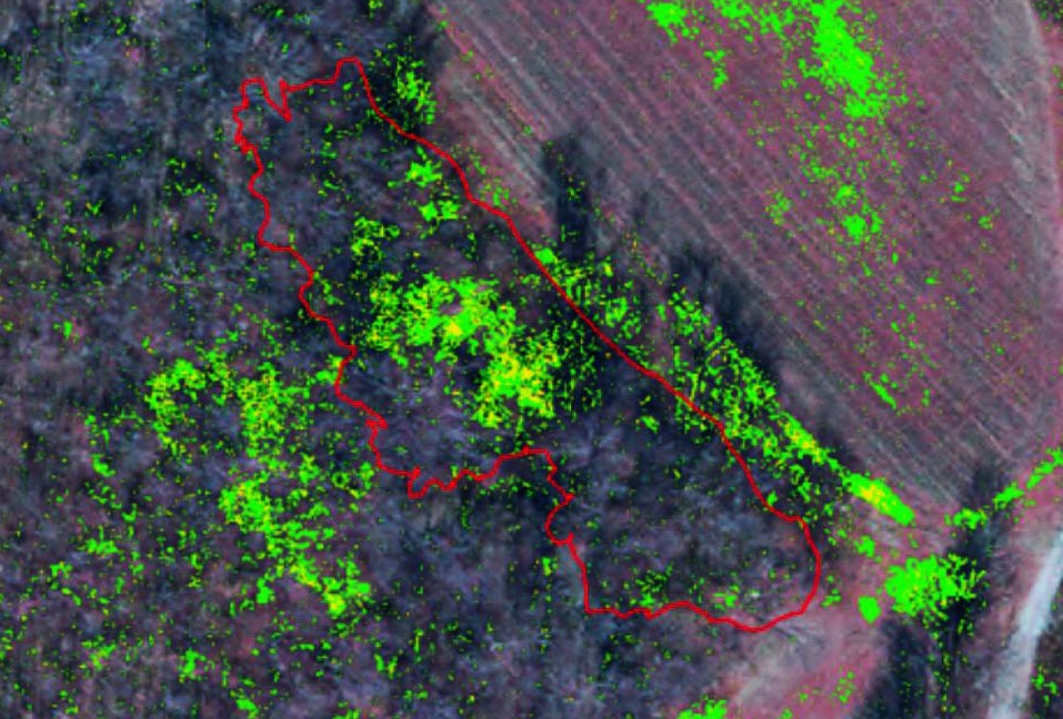
To assist in locating and mapping these alien invaders, RES collected aerial imagery in a 100-square-mile project area using both a high-resolution, multi-spectral aerial camera and complementary geo-referenced oblique aerial photography.
Collection of the imagery was completed in mid-November, strategically timed to seasonal phenology – shortly after the deciduous trees lost their leaves, but before the woody invasive shrubs had lost their foliage.
Processing of the multi-spectral imaging involved methods to ortho-rectify, color balance, mosaic, and stack imagery into four bands including red, green, blue, and near-infrared.
The near-infrared band displays the green leaves of the invasive species as the color red, which is particularly valuable for identifying the target species beneath the leaf-off forest canopy.
The imaging process was augmented by on-the-ground field inspections conducted by a RES ecologist in coordination with a GIS/remote sensing specialist. Data were used to “train” the GIS software to reliably recognize the targeted plant species on the imagery.
Through testing and ground confirmation, we determined that a spectral enhancement technique known as Normalized Vegetation Index which uses the red and near-infrared bands produced the most accurate mapping results.
Refinement and calibration produced maps of very high reliability. Thus, through a least-cost process, RES was able to give agency staff highly precise maps complete with coordinates of thousands of individual plants – facilitating their eventual removal in an eradication program.
