
North Cypress Branch Stream and Wetland Restoration


PROJECT SNAPSHOT
Project Type
Non-Bank ProjectLocation
Maryland | Anne Arundel CountyProject Size
- Wetland: 7 AC
- Streams: 3,000 LF
Solution
Natural Resource RestorationEcological Setting
- Streams
- Urban
- Wetlands
 Recipient of a 2017 Bubba Award for Best Stream Restoration, presented by the Chesapeake Stormwater Network
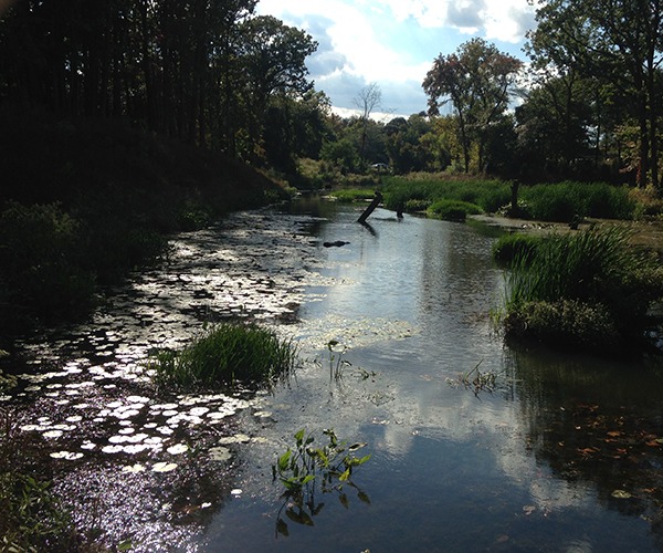
In 2012, Anne Arundel County Department of Public Works (DPW) contracted RES’ Angler Construction division to restore approximately 3,000 linear feet of main-stem stream, 900 linear feet of tributary drainages and seven acres of wetlands on the North Branch of Cypress Creek. The restoration utilized many techniques to manage the stormwater discharge in the main channel and its tributaries while creating floodplain wetlands that transition to tidal waters and removing significant pollutant load from the upstream impervious area.
The project design created an open water and shallow wetland feature to attenuate stormwater flows and reduce peak discharges through the system. Additionally, regenerative stormwater conveyances were installed to convey flow from road-based culverts. The main channel was restored to flow out of the headwater wetland into a single thread channel that conveys flow through rock and log step pools into an anastomosed or DA-type channel, which is a stream with multiple channels and islands. The middle reaches along the North Branch were excavated and filled to create floodplain wetlands. Old dam embankments were lowered, repaired, and graded to impound shallow water in the wetlands. The transition from the floodplain wetlands to the tidal channel section was reconstructed as an E-type channel to provide a gradual riffle that reconnected the tidal channel to its floodplain. This riffle allows for fish passage from the tidal area into the floodplain wetland impoundments and as far upstream as the headwater wetland.
Structures installed by RES included:
- Fifteen cobble weirs
- Fifteen sandstone outfalls
- Six floodplain grade control structures (cobble/sandstone mix)
- Four log grade control structures
- Nine boulder cobble cascades
- Six log/ boulder step-pools
Over 25,000 native plants added to the habitat creation throughout the project site. A diversity of plant species was used to create both upland and wetland habitat.