Seagal Rock Nutrient Bank
CONTACT
Credit Sales Coordinator, Virginia

PROJECT SNAPSHOT
Project Type
Nutrient BankLocation
Virginia | Halifax CountyService Area
Roanoke River BasinProject Size
- Nutrient: 438.56 IBS
Solution
Water QualityCredit Types
- Nitrogen
- Nutrient
- Phosphorus
Ask About Credits
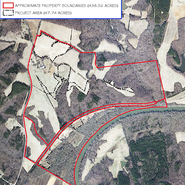
The goal of this 438.56-acre nutrient bank located in Halifax County is to reduce nutrient (phosphorus) and sediment loading into the Chesapeake Bay watershed via the conversion of active agricultural land into forest; and generate non-point nutrient credits for transfer under existing and future federal, state and local law, programs, regulations and guidance. The site primarily consists of: approximately 146.33 +/- acres of agricultural land in hay production and 26.27 +/- acres of row crop with the remainder in forest or other non-agricultural use. This site is within the twelve-digit hydrologic unit code (HUC) 030101040304. Specifically, the site drains to the Dan River, the Dan River is the principle drainage for eight-digit HUC 03010104.
